Local Walks & Cycling in the area
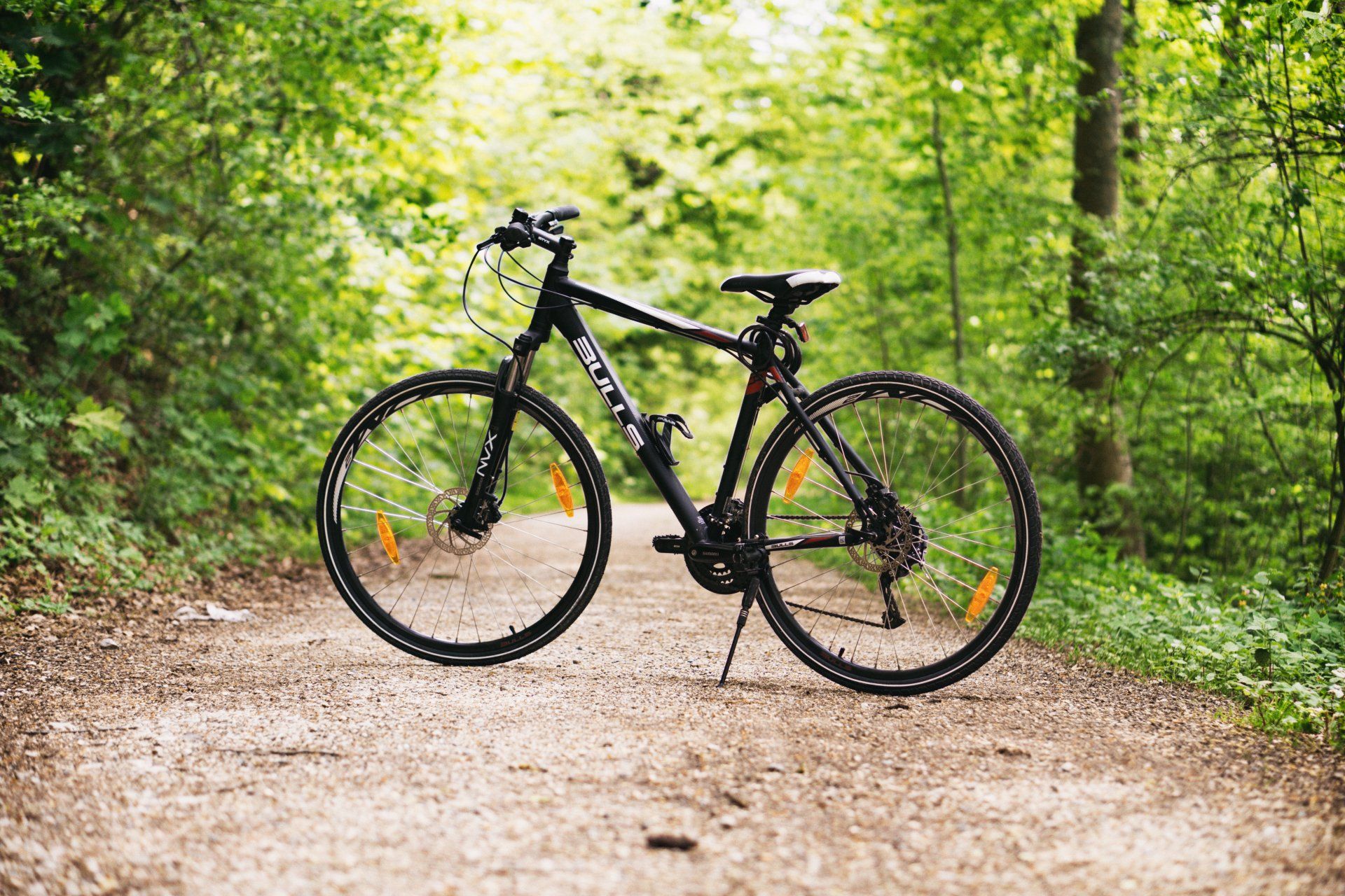
Bike Hire
Killin outdoor store, Killin
Callander, Katherine Wheels, Loch Katrine
Comrie Croft, Comrie
Cycle Routes
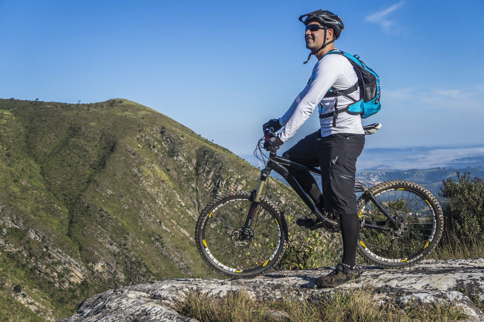
Connonish Glen
Glen Dochart Forest
Lochay loop and Glen Lochay
Callander cycle routes
Gravelfoyle cycle routes
Auch Estate over to Glen Lyon
Benmore Glen Walk
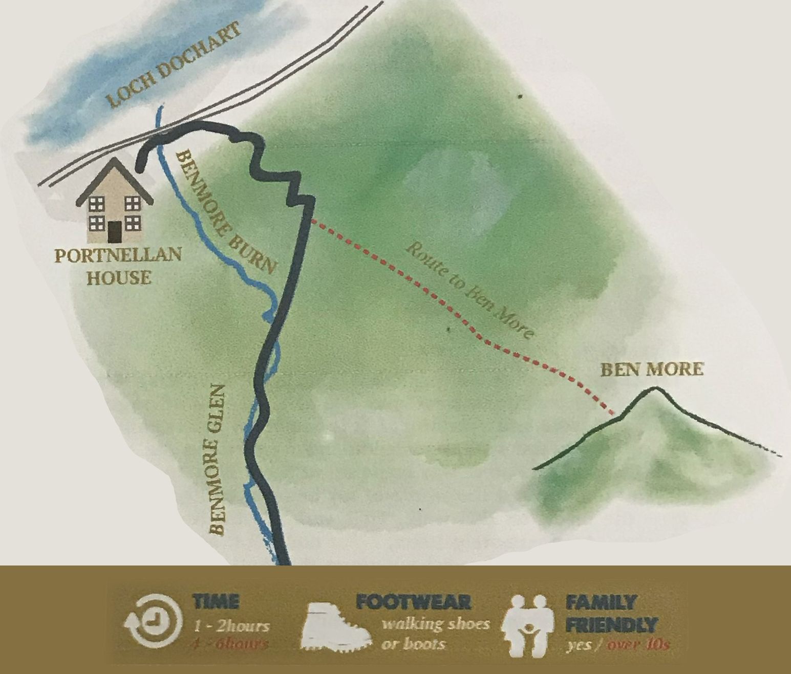
Head to the bottom of the Portnellan Estate driveway and turn right. Walk along the main road to just beyond the big green farm barn which is on the right hand side. More often than not there are cars parked on the roadside just beyond the farm barn and it is in this location you will come across a style on the right that takes you onto the Ben More Glen Hill Road. The road zigzags up to a gate and then levels out into the Glen. If the weather permits you can return to Portnellan by following the Ben More Burn to the back of the estate, hopping across the water at an appropriate place and coming into the estate just above the lodges Otter and Osprey. Alternatively, the walk is just as bonnie walking back along the hillroad. For the more adventurous who wish to tackle Ben More you can either continue up onto the Bealach - eader- dha - Bheinn at the end of the hillroad or from just beyond the gate at the top of the zigzags you can continue onto the North face of the mount up, up, up and up. You will eventually come across a beaten path that will lead you to the top. Ben More has been endorsed by world champion hill runner and fellow Scott Angela Mutch as the longest, most continual up hill slope of all the mountains in the UK. Enjoy.
Old Dismantled Railway Line
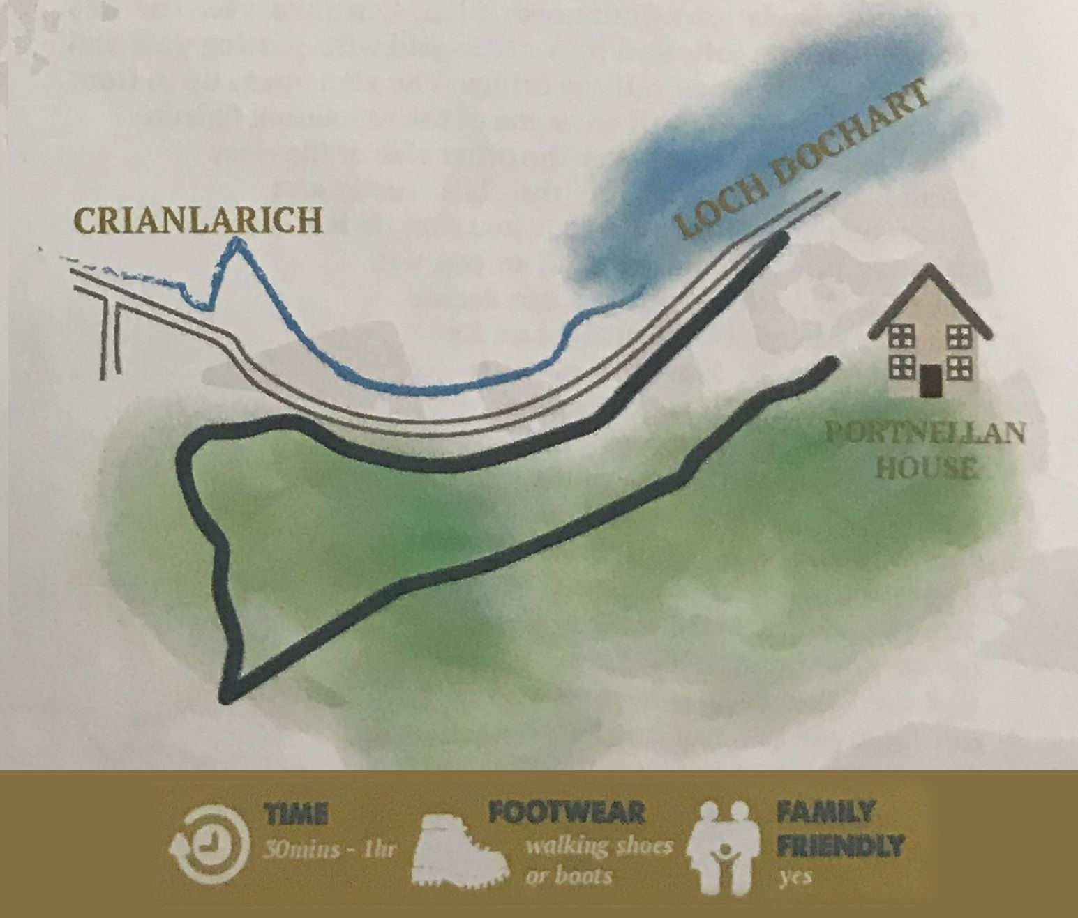
A gentle evening walk is along the old dismantled railway line alongside Loch Dochart towards Crianlarich. You can pick up this route from the Portnellan courtyard which is on the north side of the main road. There is a sign direct. It is a completely flat walking path. It can be a little overgrown in places if a tree has fallen in high winds through the winter but I assure you every effort is made by us to keep the pathway clear. The path continues to the end of the Portnellan Estate boundary where you can either decide to jump the fence and continue on the neighbouring farmland to the village or follow the pathway onto the verge of the main road. Should you wish to continue walking continue to just before the village limits where you will see a hillroad to your left. Join the hillroad and continue up onto the hillside until you reach a T junction. Bear left and follow the hillroad as if heading due East back to Portnellan. Eventually the road forks and you can take either fork. These roads come to a dead end when you can decide to scramble down into the back of Portnellan Estate or return the same way. Should you decide to scramble off road please be extremely careful under foot as off road in this area is quite technical but not impossible.
West Highland Way Sections
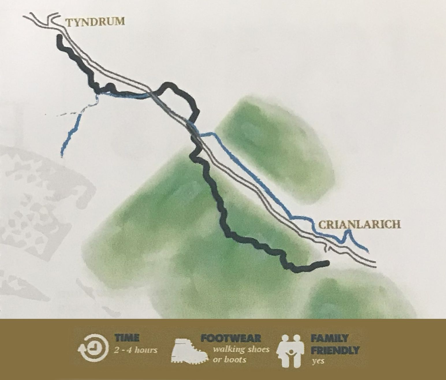
As you will know Crianlarich is situated almost at the halfway point of the West Highland Way a walk that stretches from Milngavie (pronounced Mill-Guy) to Fort William. It is a designated walk that 100s and 1000s of people embark upon yearly. Crianlarich is also famous for his railway line and the station in the village is the juncture point for the West Highland line. Trains from all over the country meet at Crianlarich to head North, West or South (the east line was a victim of Beeching but that's another story for another time) In fact, the famous Caledonian sleeper service runs to Crianlarich and beyond to Fort William meaning you can get an overnight train from London Euston direct to Crianlarich, known to the locals as a Hogwarts Express. With all this in mind you can hop on a train from Crianlarich to either Tyndrum and Bridge of Orchy to the North and walk back to the village (or vice versa) on the West Highland Way. Crianlarich to Tyndrum is approximately 8km Crianlarich to Bridge of Orchy is approximately 16km. Please note the trains are not overly regular through the day. Please collect the train timetable from the visitor centre.
Connonish Glen Walks
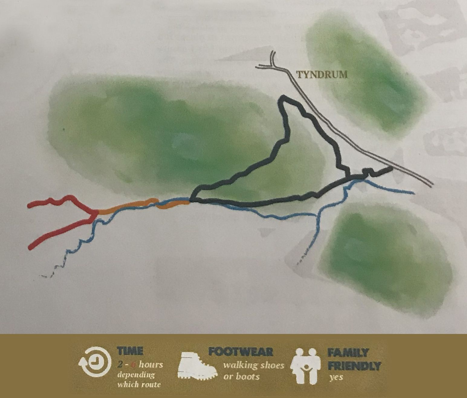
The Connonish Glen is a very special glen in our area. It is a “Site of Special Scientific Interest” and also where the UK’s first gold mine is located and operational. It is one of the last remaining areas that has some of the “Caledonian Forest” still in existence. The Caledonian Forest was made up of Scots Pine and in the days of old covered the whole of my bonnie country. You can view the forest on this walk it. This walk provides three options of distance. Approximately 10km, 12 km and 14km and they loop round through Tyndrum, back along the West Highland Way and back to your starting point at the Artisan Cafe and Craft Shop. Starting at the Artisan Cafe and Craft Shop located on the left hand side of the main road approximately 1 mile from Tyndrum (it is well signposted) you can park your car safely here and begin your walk. The walk leads beyond the cafe on what is now the old dismantled main road along the Connonish river to a fence with a stile. Just after the fence you bear left following the signs for the West Highland Way. Continue alongside the river (keeping it to your left at all times) and you pick up the hill road that leads into Connonish Glen. Continue Over the wee wooden bridge, followed by a cattle good with passing gate and then under the stone railway bridge. The Glen opens up in front of you and soon you will see some of the remaining Caledonian forest to your left over the other side of the river Connonish. Continue on the hill road and eventually you will come to a junction. It is the only junction on the road so you will not miss it. At this point you can decide whether you continue straight on for the 12km or 14km walk or turn right over the hill road through the forest and down in to Tyndrum for the 10km route. Either way you will return to the junction and head in to Tyndrum. If you continue straight on the 12km walk is up to the Connonish Farm and the 14km walk is beyond the farm on the hill road to the mountains of Ben Lui, Ben Oss, Beinn Dubhchraig. Heading back to the junction you would turn left. Continue on the hillroad which drops down to the railway line. Please take great care in crossing the line. After the railway crossing the tarmac road leads beyond the ‘By The Way’ campsite on your right and approximately 50 metres beyond the campsite turn right along the West Highland Way. The pathway continues through the forest and out through a gate. It is at this point you will see an information board on the tin mines off old that where at Tyndrum. Continue along the path and soon you will come across a wee Lochan known as the ‘Holy Loch’ the pathway brings you back to the access hill road near the start of your walk. Turn left and continue back to your car at the Artisan Café and Craft Shop where Donna and her team will welcome you with homemade food, freshly baked cakes and refreshments. Happy days. Enjoy.
Crianlarich
 Larger Map View
This tiny village has been welcoming travellers for hundreds of years. We're at the junction of two natural routes through the mountains and anyone journeying north or west comes through here.
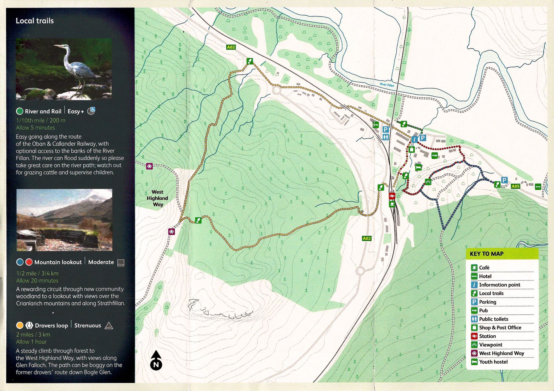
Killin Paths
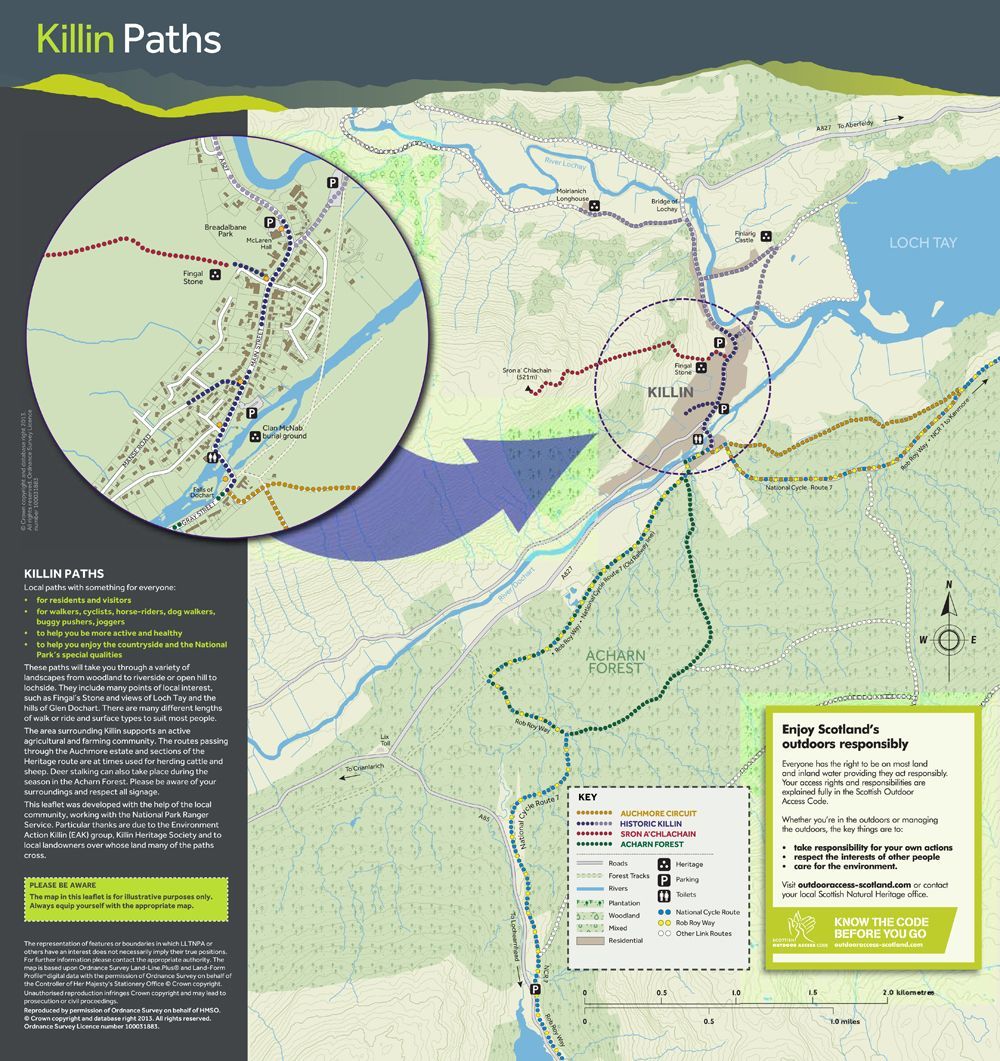 Download PDF
A National Park for everyone. It's the nations park. To discover to explore, to enjoy. It's all about finding your own space and choosing what to do with it.
SPON A' CHLACHAIN
ACHARN FOREST
AUCHMORE CIRCUIT
HISTORIC KILLIN